Earthquakes
The Earth's crust is like a big jigsaw puzzle of land pieces called plates. The plates move slowly because the layer below them is soft and flows. Constructive - plates separating Destructive - plates colliding Conservative - plates sliding past each other. Destructive
plate movement - This occurs when plates
move towards each other. Different types of collision
may take place at these boundaries. Oceanic and Continental plates or two continental plates can collide with each other. Oceanic and Continental plates colliding:
Since the oceanic plate is more dense, it is always forced underneath the continental
plate. This is called subduction (see animation below). As the oceanic plate is pushed down a deep
trench is formed. The plate melts and creates pressure in the surrounding
area due to all the melting rock. The resulting molten
rock finds its way to the surface and volcanoes form. Earthquakes also happen as the two plates slowly grind past each other. The continental crust is not destroyed. It is simply compressed, folded into anticlines and synclines and thickened to form a fold
mountain range similar to the Andes in South America.
Two continental plates colliding: When two continental
plates collide head on, neither of them is subducted.
Instead the sediment layers laying
between the two continent land masses get squeezed.
The effect is to form fold mountains similar to the Himalayas.
This type of fold mountain range has no volcanoes or deep focus earthquakes. India, in fact detached it self from Africa and piled into
the bottom of Asia. It is
still doing so, pushing the Himalayas up and up. This means Mount
Everest is getting taller by a few centimeters every year as India continues to push up into
the continent of Asia. Conservative
plate movement: When plates
slide past each other this type of movement results.
Here, material is neither created or destroyed.
The best known example of this is the San
Andres Fault in California (see animation below). It
marks the boundary between the Pacific plate and the North American plate.
These plate of rock don't glide smoothly past each other. They catch on each other and as the forces
build up they suddenly jerk.
This sudden jerking only lasts a few seconds,
but brings devastation in a built
and heavily populated area. Building come tumbling down and many people
get killed. The city of San Francisco sits along side this fault line. It was completely destroyed in 1906 and was again hit by
a powerful tremor in 1991.
This could happen again any time.
These days in earthquake
zones, developers try to build earthquake-proof
buildings which are designed to withstand small amount of shaking.
In poorer countries, earthquakes
usually cause much devastation where they have badly constructed properties, overcrowding and inadequate
rescue services. Useful Websites Title URL BBC Earthquakes Page
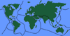
Plate Tectonics
 World map of major tectonic plates and plate boundaries
There
are 3 types of plate
movements.
Test your understanding of tectonic movements and seismic measurement based on the webpage information. 1. What is the name of the point on the Earth's surface directly above where an earthquake begins? 2. Which instrument do scientists use to detect and record the vibrations caused by an earthquake? 3. Earthquake energy travels through the Earth's crust in the form of: 4. According to the Richter scale, how much more ground shaking does a magnitude 5 earthquake have compared to a magnitude 4? 5. Why do most earthquakes occur at plate boundaries?🌍 Knowledge Check: Earthquakes
Click to Reveal Answers
2. A Seismometer (This is the device that records the movement).
3. Seismic waves (Energy is released and travels as waves through the crust).
4. 10 times more (Each number on the Richter scale represents a tenfold increase in shaking).
5. Tectonic plates push or slide past each other (The movement and buildup of pressure at boundaries cause the sudden snap).
Tags: Continental Drift, Plate Tectonics, Earthquakes, Volcano, continents moving, earthquake plates map, names of tectonic plates, plate tectonic evidence